Basic information
Flooding is an annual, meteorological-hydrological process and a completely normal event for a watercourse. The dynamics it produces form the basis for all of types of habitats and ecological communities. Humans usually consider flooding to be “abnormal” or even “unnatural” or, if nothing else, disruptive. Often the term that is used in conjunction with it is “natural catastrophe” even though flooding is, in fact, not a catastrophe from nature’s point of view.
- Flooding is the transformation of precipitation based on the water storage conditions of the catchment area. Thus, in the framework of natural storage conditions, flooding is an element of the natural water cycle. Flooding occurs when a large amount of water follows the incline of the landscape and collects in streams and river valleys within a short period of time. Rain and the water released from snow and ice when thaw sets in, are sources of natural flooding.
- The shape of the flood wave is significantly impacted by both the total volume of transported water and the timeframe in which this quantity of water converges. The water level also depends on local conditions such as inclines, channels, the availability of flood plains and vegetation.
- Flooding occurs in watercourses when the water level and discharge is clearly above “normal” (average values). Flooding is a component of the watercourse’s hydrological range of fluctuation.
- The different water levels and discharges that are recorded, so-called key hydrological figures, always refer to a specific period of observation, e.g. a year or multiple decades. Both above-average as well as below-average discharges are a natural part of flow conditions.
- The water level’s natural dynamic is the determining factor in the development and maintenance of the habitats and ecological communities native to the watercourses and floodplains of the rivers and streams. The dynamics of groundwater level, the morphodynamics (collapsed river banks), the accumulation of sand, gravel and sludge, the dynamics of the location and the vegetation e.g. the development of the floodplain forests, as well as the discharge of nutrients and the exchange of organisms all depend on this.
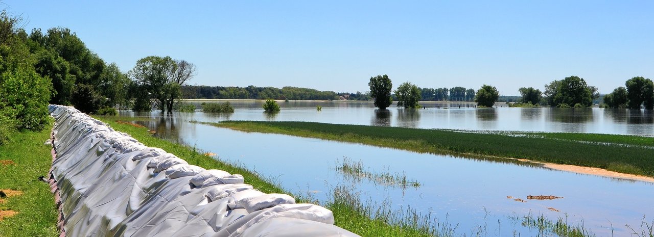
- While naturally occurring flooding is essential to the existence of the flora and fauna, flooding in inhabited areas can be dangerous for the people living and working there and for their material goods.
Factors that influence flooding
General
Floods are usually compared to one another, however is should be noted that no flooding incident is the same as another. This fact is caused by the natural and anthropogenic changes which are continuously occurring in the drainage basin of the watercourse and by the many factors influencing the formation of flooding and flood discharge.
- Flooding primarily depends on the intensity of the precipitation and the timeframe of the snow melting process (taking the quantity of the snow pack in the collection area into consideration). It also depends on the length of time and volume of the precipitation, the timeframe and spatial distribution of the precipitation and the absorption possibilities and capabilities of the soils in the catchment area (water saturation through pre-wetting, level of density, ice cover, vegetation cover etc.).
- Furthermore, flooding, its duration and speed all depend on the storage capacity of the vegetation, soil, terrain and water network of the affected floodplains throughout the entire flood zone. This particularly applies to the middle courses and lower courses of the rivers of large catchment areas.
Vegetation
Floodplain vegetation can have a big impact on flooding depending on the season, i.e. whether its “green or not green”. Vegetation is primarily storage-capable at the start of precipitation since the rain initially “gets caught” on the trees and plants before it reaches the ground. During the vegetation period, grassland can store up to two litres of precipitation per square metre and forest up to five litres. In principle, the denser the vegetation, the higher the water retention. Evaporation occurs once the rain has stopped, leading to “multiple usage” of the vegetation’s storage capacity.
It is important to keep local, regional and supra-regional aspects in mind when it comes to the impact vegetation has on flooding. Vegetation in river floodplains, particularly softwood and hardwood floodplains, has a positive effect on lowering the flood peak.
- The species composition of the vegetation and its habit provide resistance to the flowing water. The onset of the flow-retarding rise in roughness is at a much later point in time for older trees due to the formation of higher, solitary or groups of stumps. The habit depends on the species of tree and on the often ignored ice shearing during winter flooding. Bushy willow species “lie down” as a result of the hydraulic pressure of the water once a specific speed of flow and water level are reached and in the case of ice drift. Then the resistance produced from the roughness can slowly start to lower again over the population of trees.
- The size of the population and density of the growth can lead to a considerable increase in roughness for narrow waterways.
- The direction and distribution of the vegetation against the inflowing water is an important influencing factor. For example there is usually little flow resistance for gallery forest populations positioned in the linear direction of the current, which are often found near the main stream of the Elbe.
- In addition to possible local effects on a rising flood peak, vegetation in the river floodplains has a positive effect on lowering the flood peak from a supra-regional perspective when the entire system is taken into consideration.
- The stabilization caused by the vegetation and the lowering of the water table are the result of temporal discharge delays due to a rise in roughness in the channel and by the interaction between the floodplain and the main channel.
- The overall ratio of the vegetation has a cumulative effect on stabilizing the water table. In other words, the more vegetation coverage there is on the floodplain and along the course of the river, the larger the effect will be in the downstream direction.
- The spacious distribution of the softwood floodplains, which ideally should start at the headwaters of the main stream and tributaries, plays a positive role. The same holds true for small drainage basins and the typically occurring black alder and/or grey alder-ash forests accompanying the streams.
Soils
Soils are a relevant factor for the development of flooding. The following rule applies: the more natural the ground is and the less impacted by agricultural use or overdevelopment it is, the better it can cope with flood retention.
- Floodplain soils are a powerful instrument for storing water. They can store up to one hundred times more water than vegetation can. The soil cavities, which depend on the humus content, soil depth and soil density, play a decisive role in this. The rooting of the vegetation supports the absorption capacity of the soil.
- The amount of water already stored before the flood wave hits limits the soil’s absorption capacity. When the soil has been saturated it can no longer store any additional water and water flows above ground. In other words, the effectiveness of the soil’s water storage capacity depends on previous precipitation. Ground frost also limits absorption.
Terrain/watercourse network
The terrain and the watercourse network also have a great impact on flooding. This is reflected in the hydrological retention capacities based on volume and area, hydraulic retention of natural river floodplains due to an early overflowing into the existing watercourse system of the floodplain and the roughness of the terrain.
- The steeper the slope of the terrain, the less water is retained in the area when precipitation quickly collects. Thus water retention in the highlands is limited by natural means. In the lowlands, particularly in the region of wide floodplains, a considerably high amount of water is retained.
- Waterways and their networks have an important storage function, whereby the storage effect of extensive floodplains in the lowlands is highest. This is supported considerably by a waterway’s near-nature properties, i.e. its shape and course, as well as the ratio of near-nature and natural water network components such as low wetlands, abandoned channels, oxbow lakes and high tide channels.
Anthropogenic factors
In the past few centuries, humans have played a decisive role in shaping the flood wave and the flooding process in the affected water catchment areas, including along the Elbe. The impact on the Elbe can be summarized as follows:
- Changes in agricultural usage, particularly in the highland areas at risk of erosion and in areas with strong precipitation, as well as through a considerable reduction in forest cover due to damage (even in small catchment areas in the upper course) and changes in tree species composition as a result of changes in the area’s drainage (common spruce monocultures instead of near-nature, location-appropriate mixed deciduous forests).
- Watercourse expansion measures with channel shortening and modifications made to hydraulic conditions even in small tributaries as well as in main channels. Expansion measures in the past (e.g. cutting off meandering and disconnecting and dyking river bends) have led to a significant shortening of the Elbe’s course by around 55 km in the Czech Republic and around 60 km in Germany. This, in turn, has led to considerable bed erosion which has had a negative impact on the shape of the flood wave in extreme cases.
- Impermeable surfacing and central precipitation drainage in all residential areas and an acceleration of damage by building on top of natural floodplains throughout the entire area.
- The gradual erection of a connected chain of barrages on the Bohemian Elbe and, primarily on the Lower Moldau, since the second half of the 19th century with the aim of making the rivers passable by ship. This has led to considerable changes in wave travel times during incidents of flooding.
- Dyke building since 1160, i.e. for around 850 years, with a substantial reduction in natural retention and flood areas (e.g. more than 80% of the floodplains along the Middle Elbe have been lost). In addition to the loss of space, there has been a clear impact on the wave travel times through changes in roughness and hydraulic conditions.
Flood management
New concepts for managing floods in an ecological way have not yet been put into practice enough. These include:
- The reforesting and renaturation of small watercourses in the upper catchment areas, in particular in areas at risk of heavy rain, coupled with re-establishing permeable surfaces.
- Measures to increase channel roughness with the fundamental aim of extending the timeframe of the flood wave (reactivation of the Elbe’s dead stream branches while concurrently relocating dykes and planting floodplain forests).
- Relocating dykes with the aim of widening hydraulically disadvantageous discharge cross-sections, achieving localized lowering of the water table and preventing dyke sections that are positioned perpendicular to the current (risk of ice packing).
- Preventing disproportionate intervention that cannot be restored or compensated for. This applies to very old tree stocks in need of protection on and in the dyke. Here the aim should be to reroute dykes and/or strengthen dykes on one side.
- Preventing expansion measures that produce bed erosion and implementing suitable measures for decisively minimizing bed erosion that has already occurred. This should take place, in particular, along the Middle Elbe between Torgau and Wittenberg.
- Fundamental changes in unsuitable agricultural usage, i.e. ceasing farming of intensive arable crops and moving towards extensive grassland utilization or planting floodplain forests. In addition to various areas in the floodplain, this particularly applies to flood polders along the Lower Havel. Here ecologically oriented flooding without extreme flooding helps prevent extremes of water quality economy and promotes ecological changes.
The 2002 Elbe flood
Flooding along the Elbe often occurs as a result of intensive rain or snow melt. In August 2002 an area of low pressure named “Ilse” was responsible for an extreme, so-called 5b weather situation. Humid Mediterranean air moved across the eastern Alps towards Bohemia and Saxony. In the Erz Mountains there was heavy and extensive rainfall which fell onto saturated soil. Three hundred and twelve litres per square metre of rain were recorded at the weather station at Zinnwald. Many hours of tropical-like precipitation quickly transformed the tributaries of the Upper Elbe into powerful currents which destroyed railway embankments, roads, bridges and homes. The stream “Wilde Weisseritz” swelled to 120 times its usual level. Dresden’s old town, originally a part of the Elbe riverbed, was flooded. As the situation began to relax, more water from Bohemia flowed down the Elbe to Saxony. On 17 August 2002 a peak water level of 9.40 m was reached. Levels here are normally only 2 metres on average. Parts of Dresden’s historic old town were under water for days. Every day more dam breaches were reported near villages and cities along the upper course.
Dessau was also affected by flooding. The Mulde, a tributary of the Elbe was transformed into a raging river by the extreme rainfall in the Erz Mountains. The flooding moved to Dessau, the place where the Mulde joins the Elbe. Dams broke and placed the neighbourhood of Dessau-Waldersee under water. A break in a dam along the Mulde, which led to uncontrolled flooding of the Goitzsche, a former open pit mine, de-escalated the situation. The Goitzsche absorbed 44 million m³ of water from the Mulde in just a few days. Controlled flooding was originally planned over a course of 10 years.
The flooding situation de-escalated after Dessau. Here the Elbe floodplain forests on the biosphere reserve were able to accommodate some of the floodwaters. Moreover, the Saale did not release any more floodwater into the Elbe. The weir at Pretzien was opened and eased tensions in the cathedral city of Magdeburg. Large amounts of water from the Elbe were routed around Magdeburg. Opening the weir dramatically reduced flood levels.
Two hundred cubic metres of water per second poured into the Havel polder near Neuwerben. The level of the Elbe sank for a few days. The Prignitz region, areas close to rivers in Saxony-Anhalt, Lower Saxony and Schleswig Holstein all profited from this.
Above-average rainfall was also responsible for the Elbe flood. Damage would have been much less if there hadn’t been such extensive encroachment upon the rivers and floodplains previously. In Germany, the Elbe has been straightened and dyked along most of its entire course. More than 80% of the natural retention capacity (2.4 b m²) has been lost. Roads, residential areas and industrial estates are located directly on the floodplains. Deforestation along the ridges of the Erz Mountains during early industrial times and damage to mountain forests through environmental pollution are further causes for the extreme effects of the Elbe flood.
Flood damage in Saxony-Anhalt alone amounted to around 2 billion euros. There were 87.5 million euros worth of damage to flood control facilities. Around 60,000 people had to temporarily leave their homes.


